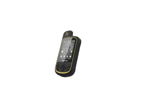
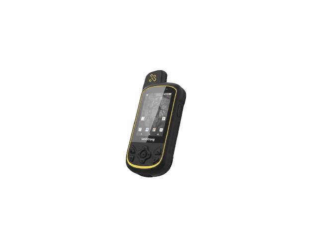
GIS Data Collector
RDC20 Outdoor GPS Handheld delivers precise positioning with advanced multi-band, multi-constellation technology. With a long-lasting battery, a rugged yet stylish design, and preloaded detailed maps, it empowers you to tackle any outdoor task with confidence.
Fast acquisition, unwavering accuracy.
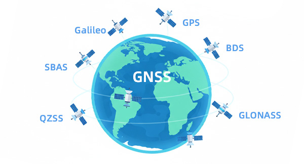
RDC20 handheld supports all major GNSS constellations — BeiDou, GPS, GLONASS, Galileo, and QZSS. With SBAS differential correction and an independent BeiDou operation mode, it ensures strong signal reception and highly stable, precise positioning.

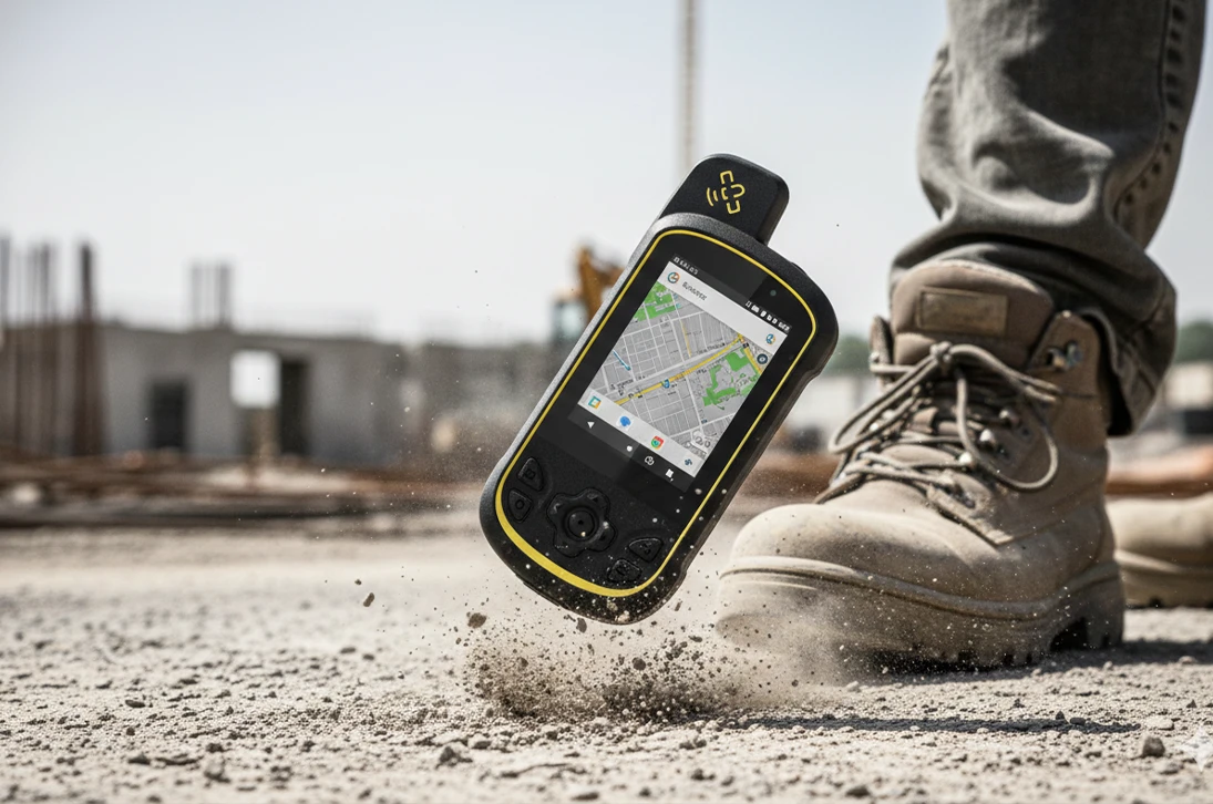
Rugged design, lightweight and durable
Built with industrial-grade construction and design, the RDC20 is dustproof, waterproof, and features a sunlight-readable screen. Ready for any outdoor environment.
Ready to Use, Fully Loaded
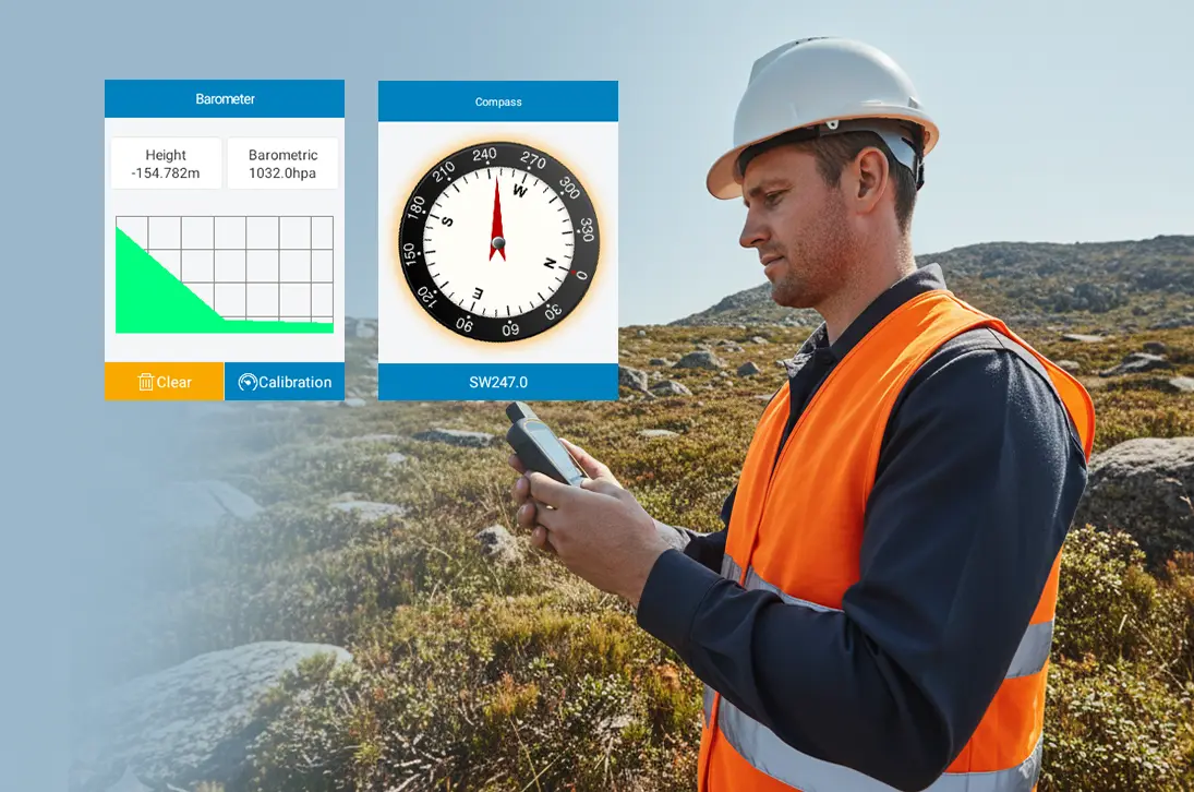
Equipped with a digital compass, thermometer, and barometric altimeter, the RDC20 provides accurate and convenient navigation. This integrated suite measures ambient temperature and significantly improves the accuracy of altitude readings.
Worry-free & Work all day
Powered by a 4000mAh lithium battery, the RDC20 delivers over 16 hours of continuous operation and supports power-bank charging. Stay powered through extended missions, without the worry of running out.

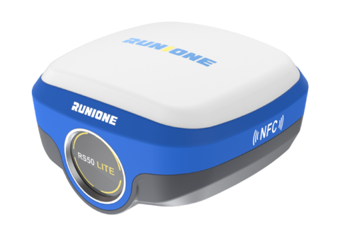
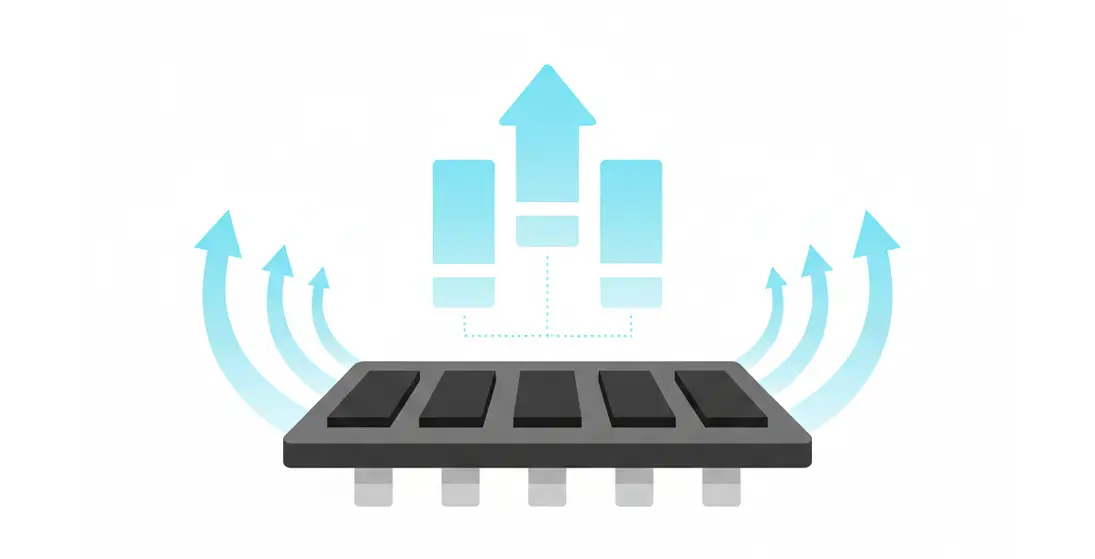
Designed as a reliable positioning foundation, this module integrates full-constellation support with advanced satellite-based augmentation and differential correction, providing consistently stable and precise positioning even in challenging signal environments.
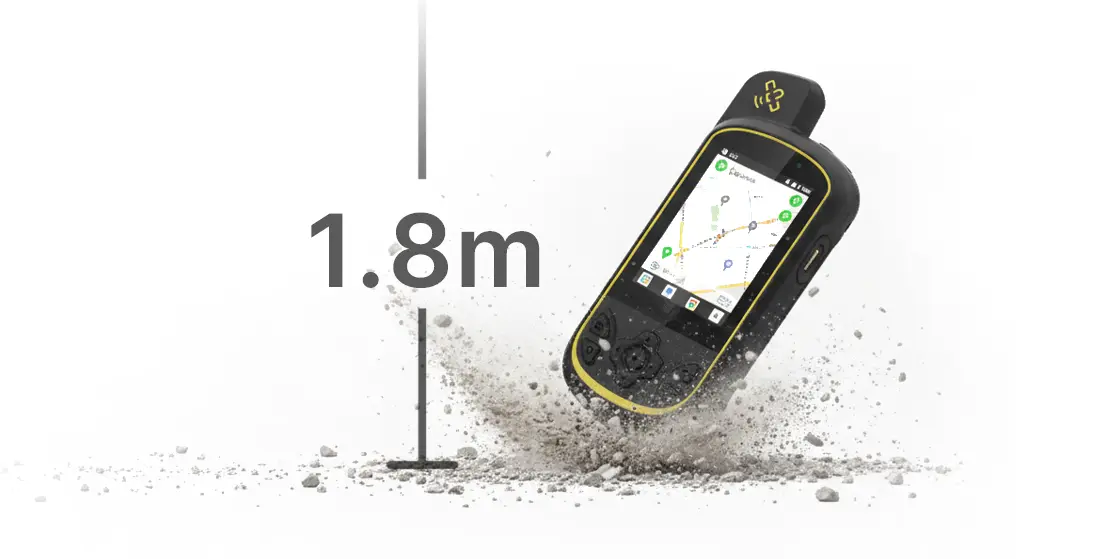
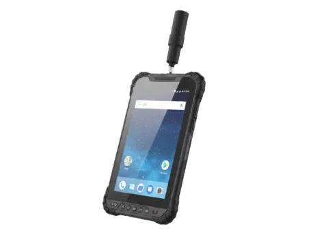
Designed to resist extreme conditions, the housing guarantees complete sealing integrity (IP68) against dust and water ingress. Its structure is fortified to withstand accidental impacts from drops up to 1.8 meters, ensuring operational reliability where failure is not an option.
Equipped with 2GB+16GB storage and expandable via microSD card. Enhanced by high performance memory chips for faster read/write speeds, it easily handles large capacity data storage needs.
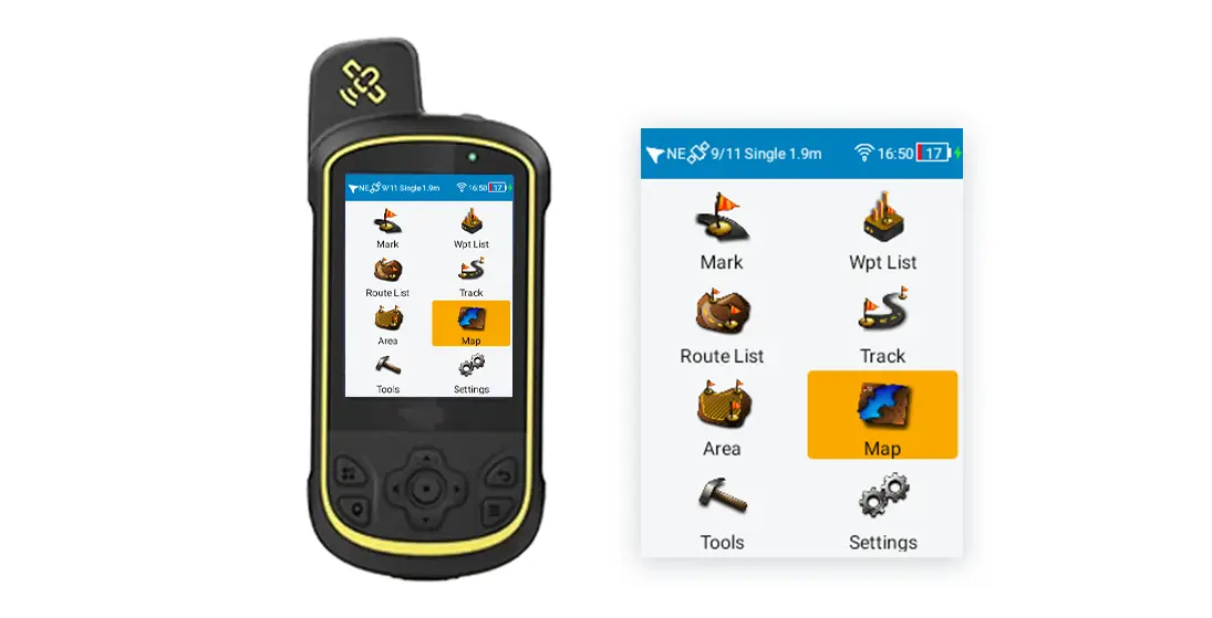
Built in MobileNav professional positioning software-easy, accurate, efficient.
| Physical Parameter | |
| Size | 142 x 66 x 28 mm |
| Weight | 228g |
| Display | 2.8-inch |
| Ports | Type-C USB 2.0 |
| Hardware | |
| OS | Android 10.0 |
| RAM | 2 GB LPDDR3 |
| ROM | 16 GB eMMC |
| Battery | 3.8V 4000mAh |
| Communication | |
| GNSS | GNSS:BDS/GPS/GLONASS/GALILEO |
| Positioning Accuracy: Better than single point positioning 5 meters, SBAS positioning 1-3 meters | |
| Communication | Bluetooth 4.0 |
| wifi2.4:802.11b,g,n | |
| Reliability | |
| Operating Temperature | -20℃~+60℃ |
| Storage Temperature | -30℃~+70℃ |
| Humidity | 0-95% relative humidity, no condensation |
| Electrostatic Discharge | Contact 8KV, Air 12KV |
| Protection Level | IP68 |
| Drop Resistance | 1.8 meters drop onto marble |
Become Partner
CONTACT SALESSpec Sheet
DOWNLOAD
Runione Survey is professional GNSS survey software designed for engineering measurement and construction stakeout. Built around stability, reliability, and efficiency, it enables surveyors to deliver consistent and trustworthy results in real-world construction environments.
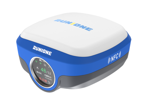
A comprehensive, precise, and technologically advanced field data collection solution. Equipped with a full-constellation, multi-band GNSS module capable of centimeter-level accuracy, it meets the demanding needs of GIS applications in complex environments, delivering stable and reliable core support for fieldwork.

RS Base is a professional GNSS base station receiver with a built-in 5 W high-power UHF radio for long-range RTK operations. It supports multiple communication methods and efficient web-based configuration. Under ideal conditions, the 5 W radio provides up to 30 km of stable RTK coverage.