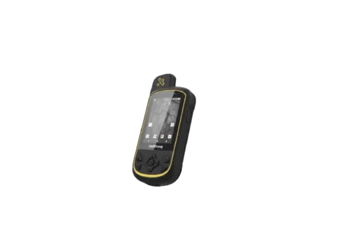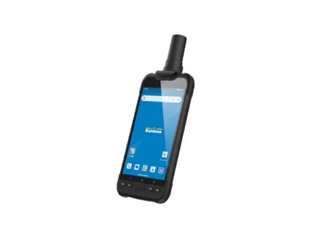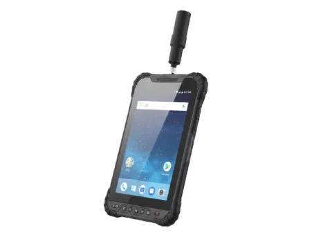
GIS Data Collector
A comprehensive, precise, and technologically advanced field data collection solution. Equipped with a full-constellation, multi-band GNSS module capable of centimeter-level accuracy, it meets the demanding needs of GIS applications in complex environments, delivering stable and reliable core support for fieldwork.
Rapid and Accurate
The RDC60 features a built-in 5-constellation, 14 band antenna with anti interference technology, delivering fast positioning and stable, reliable data. No SDK required—enjoy centimeter level accuracy anytime, anywhere. Skip complex setup and get straight to work.

Rugged and Reliable
Built to industrial standards with a robust design, the RDC60 is dustproof and waterproof. Its 8000mAh removable battery supports all day operation, making it ready for the toughest conditions.

Supports third-party software
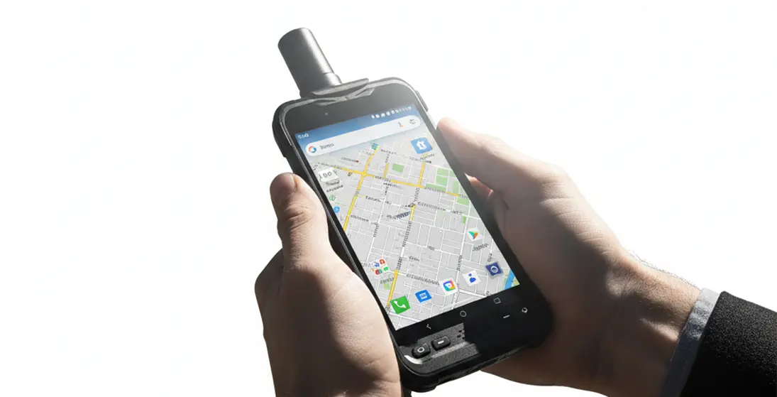
Runs on Android and offers deep compatibility with mainstream professional GIS software for direct deployment across project scenarios. It can operate as a standalone GIS data collector or be flexibly paired with GNSS receivers, extending application possibilities and multiplying field efficiency.

Seamless connectivity and sync for efficient collaboration
Integrated connectivity — combining GNSS, Wi‑Fi, cellular, Bluetooth, and NFC — bridges the field and the office seamlessly. High‑speed data transfer and real‑time sync break down barriers between onsite and in‑house work, boosting collaboration and streamlining the entire workflow.


Full-constellation professional‑grade GNSS module and antenna covering GPS, Galileo, GLONASS, BeiDou, QZSS, and SBAS — delivering precise, stable positioning.
The 6-inch ultra-bright, high-resolution display is engineered for outdoor visibility. It maintains excellent contrast and clarity under direct sunlight, allowing for comfortable viewing and uninterrupted workflow in challenging lighting.
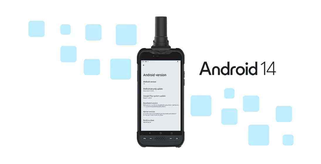
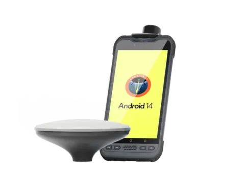
This device runs Android 14.0 with full GMS certification. Ensuring complete integration with the Google ecosystem for secure, stable, and long-term access to Google Mobile Services.
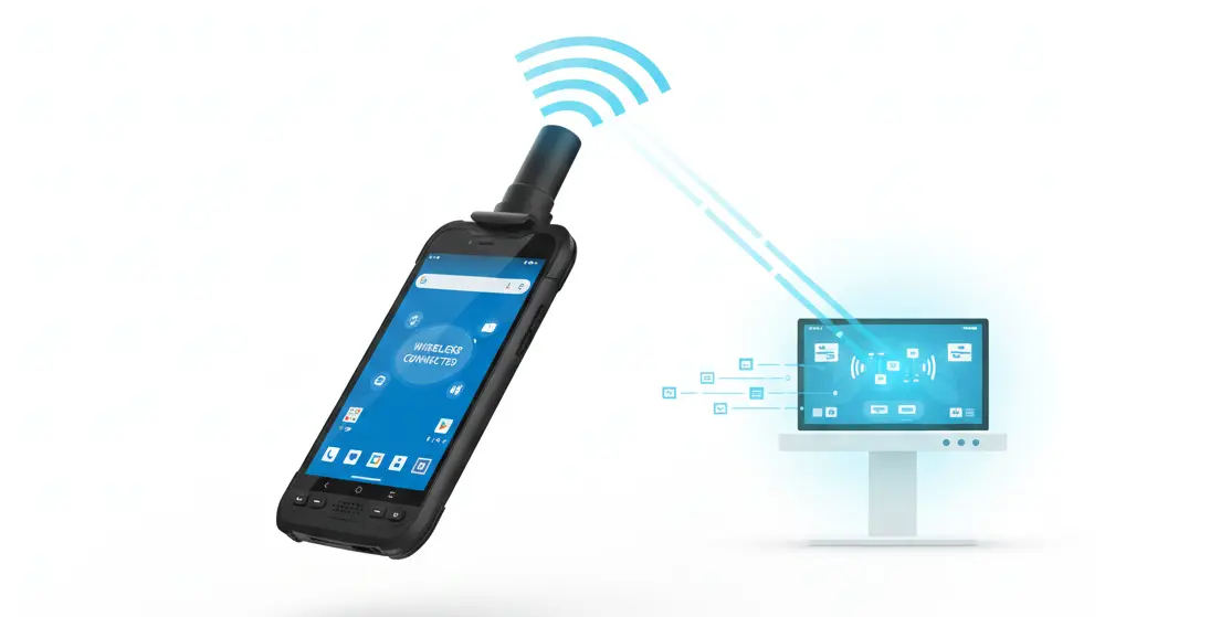
With built-in 4G LTE, GNSS, Wi Fi, Bluetooth, and NFC, field data syncs seamlessly with the office in real time. Stay connected anywhere.
| Physical Characteristics | ||
| Size | 193.5 x 93 x 15 mm | |
| Weight | ≤390g | |
| LCD | 6.0”IPS 1080x 1920 FHD 550nits | |
| Camera | 8M FF | |
| 32M AF | ||
| Hardware | ||
| CPU | Qualcomm QCM4490 Octa-core | |
| OS | Android 14 GMS | |
| RAM +ROM | 8GB LPDDR4X + 128GB UFS2.2 | |
| Battery | 3.8V 8000mAh | |
| Communication | ||
| GNSS | A-GPS / GPS L1+L5 / GLONASS / Galileo / Beidou | |
| WiFi | IEEE 802.11 a/b/g/n/ac/ax ( 2.4 & 5GHz Wi-Fi6E ) | |
| Bluetooth | BT 5.2 BLE | |
| NFC | NFC 13.56MHz, work distance ≥ 3cm | |
| Cellular | GSM: 850 / 900/ 1800 / 1900 WCDMA:B1/B2/B5/B8 LTE-TDD:B38/39/40/41 LTE-FDD: B1/2/3/4/5/7/8/12/13/14/17/20/25/26/28/48/66/71 5G: FR1 N1/2/3/5/20/28/41/48/66/71/77/78/79 |
|
| High Precision Module | ||
| Accuracy | Single Point Positioning (RMS) Horizontal: 1.5 m Vertical: 2.5 m DGPS (RMS): Horizontal: 0.4 m Vertical: 0.8 m RTK : Horizontal: 0.8 cm + 1 ppm Vertical: 1.5 cm + 1 ppm |
|
| Reliability | ||
| Working temperature | -20℃~+60℃ | |
| Storage temperature | -40℃~+70℃ | |
| Humidity | 0-95% RH, non-condensing | |
| ESD | Contact 8KV,Air 12KV | |
| Water proof | IP68 | |
| Drop | 1.5 m to marble | |
Become Partner
CONTACT SALESSpec Sheet
DOWNLOAD
Runione Survey is professional GNSS survey software designed for engineering measurement and construction stakeout. Built around stability, reliability, and efficiency, it enables surveyors to deliver consistent and trustworthy results in real-world construction environments.