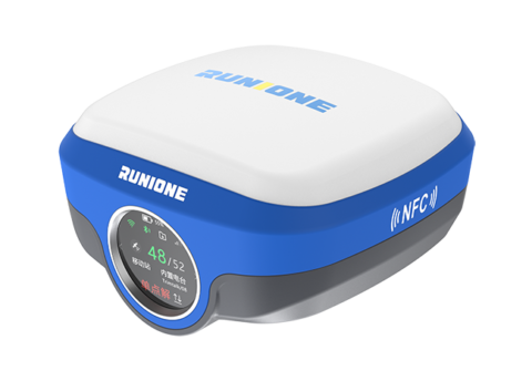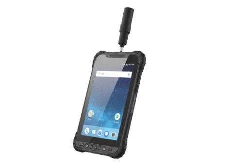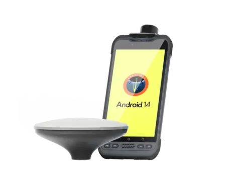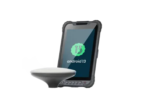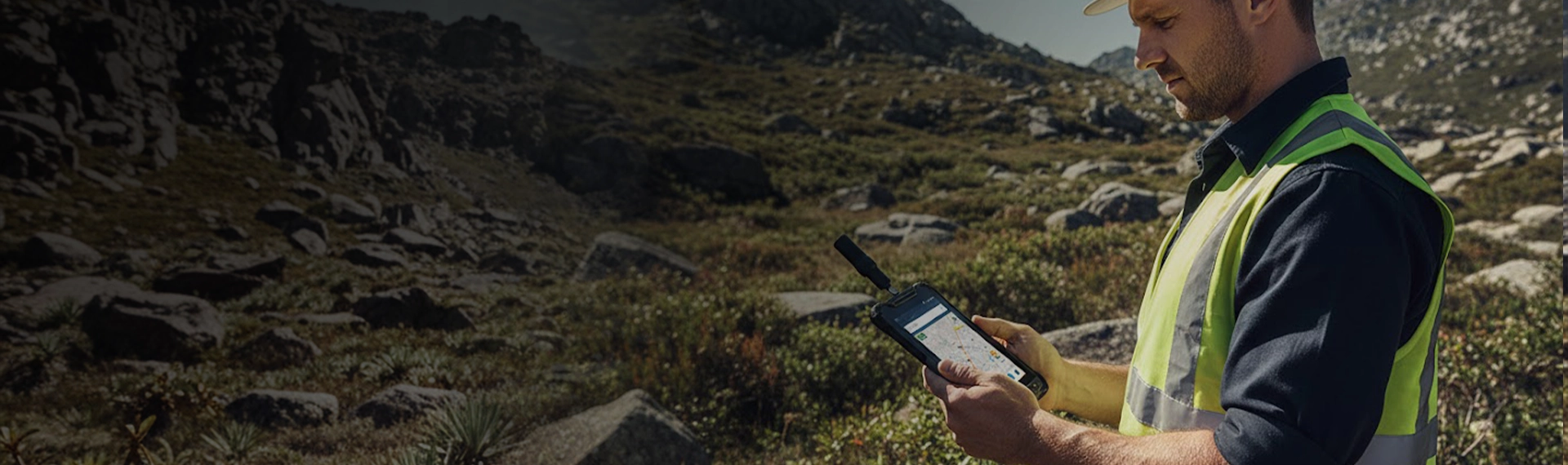
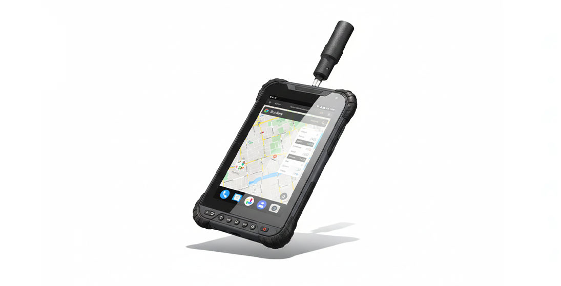
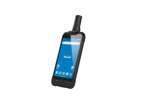
GIS Data Collector
RDC80 is a high‑end, fully‑featured, and precise Android GIS tablet. Built with industrial‑grade hardware and delivering centimeter‑ to decimeter‑level positioning accuracy, it empowers efficient high‑precision data collection and mobile workflows across surveying, inspection, agriculture, and beyond.
Rapid Deployment, Reliable Accuracy
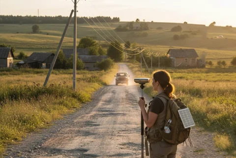
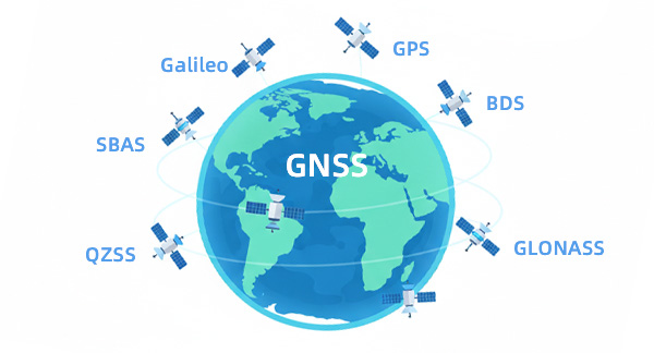
The RDC80 delivers reliable, high‑precision positioning under 2cm for demanding field applications. It integrates a full‑constellation GNSS module with built‑in RTK and Galileo HAS to ensure robust performance in surveying, mapping, and precision workflows

Engineered for Harsh Environments
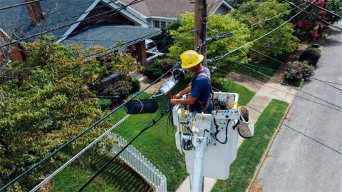
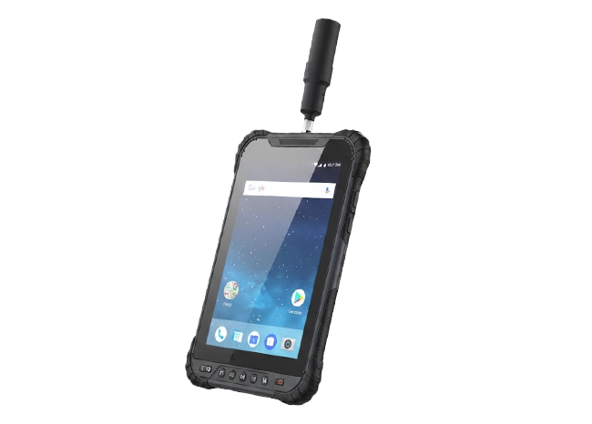
The RDC80 features a rugged industrial-grade build with IP67 dust/water resistance and an 8200mAh removable battery for all-day operation. Engineered for demanding conditions, it delivers the durability and sustained power required for critical mobile data workflows.

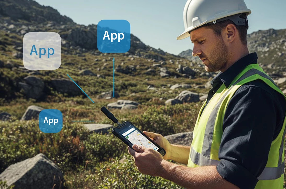
Professional GIS Workflow Flexibility
Running on Android, it offers certified compatibility with major GIS apps. It functions as a standalone data collector or integrates as a controller for GNSS receivers. This dual-mode flexibility adapts to complex tasks, significantly boosting field productivity.
Full-Stake Connectivity & Live Sync
Integrated GNSS, WiFi, cellular, Bluetooth, and NFC support ensures no lag data transfer and synchronization between the field and the office. This direct link removes traditional bottlenecks, fostering transparent and efficient collaboration across all teams.

This system combines an 8-core 2.0 GHz processor with a professional, full-constellation GNSS engine, delivering the responsive and reliable performance required for engineering-grade field equipment.
An 8-inch high-luminance, high-resolution touchscreen ensures exceptional outdoor visibility, reliable touch response, and uninterrupted operation in direct sunlight.
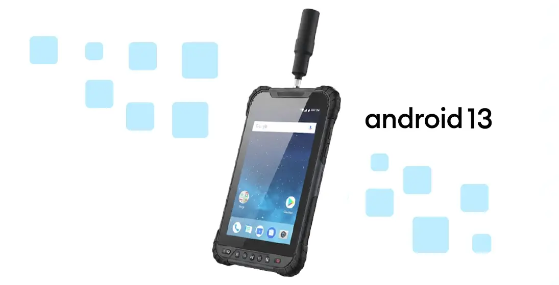
Runs the official, GMS-certified Android 13.0, ensuring full compatibility with Google’s ecosystem. This certification validates system stability and secure access to Google Play services.
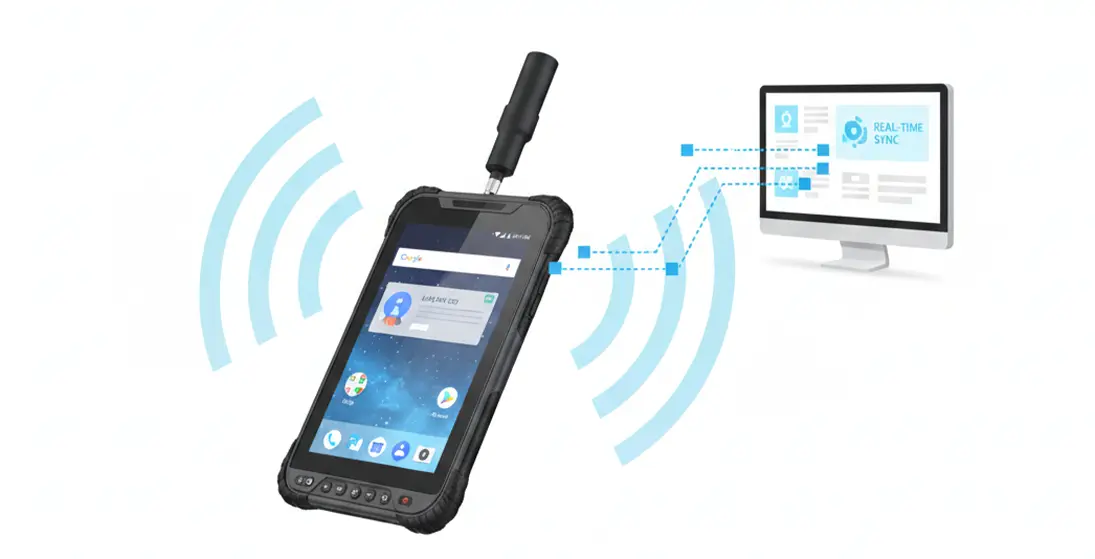
Features integrated 4G LTE, GNSS, Wi-Fi, Bluetooth, and NFC to maintain constant connectivity and real-time data transfer from any location.
| Physical Characteristics | ||
| Size | 235 ×146 ×14.5 mm | |
| Weight | 610 g | |
| Rear Camera | 16 MP, auto-focus | |
| Front Camera | 8 MP, fixed-focus | |
| Hardware | ||
| CPU | Qualcomm QCM4290 | |
| OS | Android 13.0 | |
| RAM+ROM | 6GB LPDDR4X + 128GB eMMC | |
| Battery | 3.8V 8200mAh removable | |
| Communication | ||
| GNSS | Beidou/GPS/GLONASS/Galileo | |
| WiFi | 802.11 a/b/g/n/ac (Dual Band 2.4 & 5GHz) | |
| Bluetooth | BT5.1 @BLE | |
| Cellular | TDD-LTE : B38/B39/B40/B41 FDD-LTE : B1/B2/B3/B4/B5/B7/B8/B12/B13/B17/B20/B25/B28(b)/B66 |
|
| WCDMA B1/B2/B5/B8 | ||
| 850/900/1800/1900 | ||
| High Precision Module | ||
| Accuracy | Single Point Positioning (RMS) Horizontal: 1.5 m Vertical: 2.5 m DGPS (RMS): Horizontal: 0.4 m Vertical: 0.8 m RTK : Horizontal: 0.8 cm + 1 ppm Vertical: 1.5 cm + 1 ppm |
|
| Reliability | ||
| Working Temperature | -20℃~+60℃ | |
| Storage Temperature | -40℃~+70℃ | |
| Humidity | 0-95% RH, non-condensing | |
| ESD | Contact 8KV,Air10KV | |
| Water proof | IP67 | |
| Drop | 1.2m to marble | |
Become Partner
CONTACT SALESSpec Sheet
DOWNLOAD
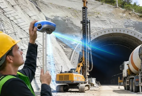
Runione Survey is professional GNSS survey software designed for engineering measurement and construction stakeout. Built around stability, reliability, and efficiency, it enables surveyors to deliver consistent and trustworthy results in real-world construction environments.
A comprehensive, precise, and technologically advanced field data collection solution. Equipped with a full-constellation, multi-band GNSS module capable of centimeter-level accuracy, it meets the demanding needs of GIS applications in complex environments, delivering stable and reliable core support for fieldwork.