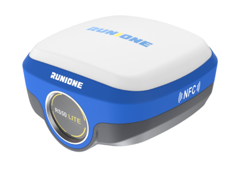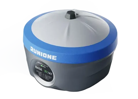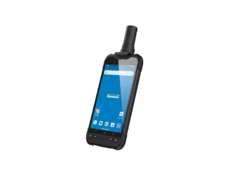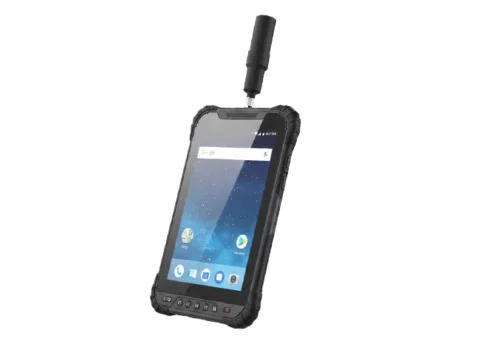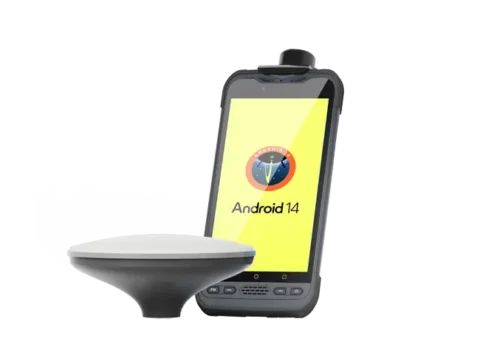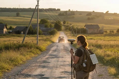
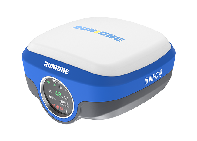
GNSS RTK Receiver
RS50 Pro is a visual fusion surveying system integrating laser measurement and dual-camera AR stakeout for stable centimeter-level accuracy in GNSS-challenged environments.
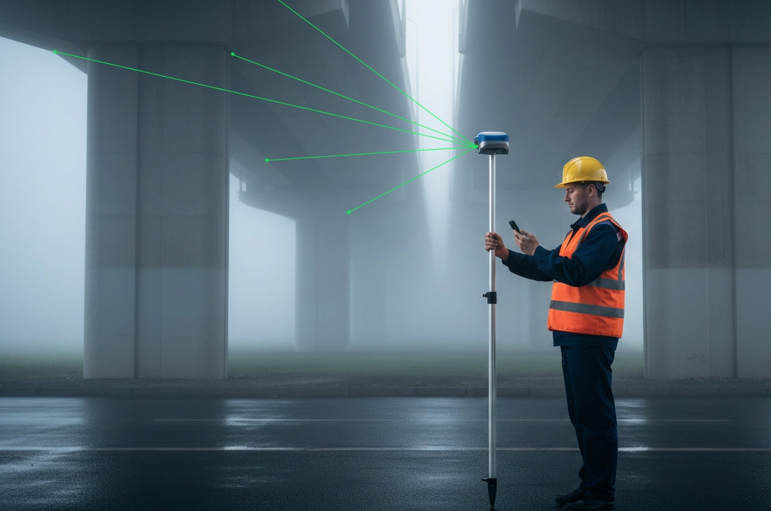
Stable Measurement in Challenging Environments
RS50 Pro leverages a multi-source fused laser measurement system to maintain stable and continuous surveying performance even in heavily obstructed or constrained conditions, providing reliable support for high-difficulty surveying tasks.
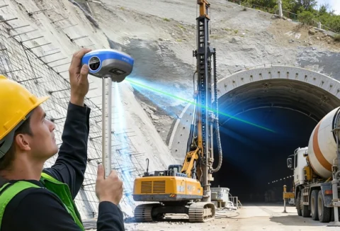
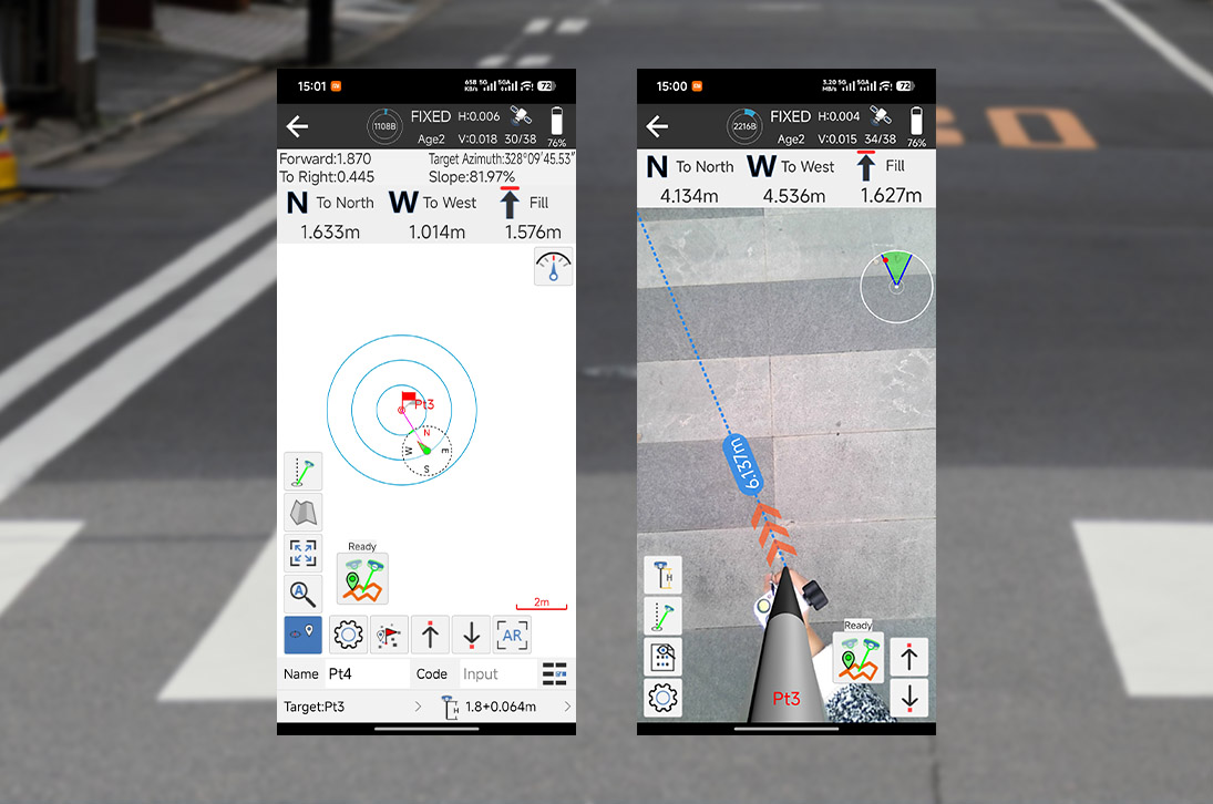
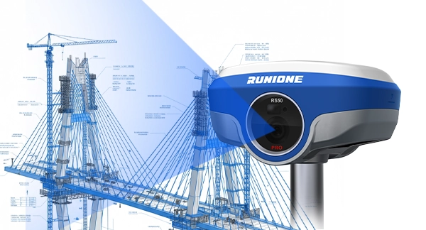
Dual-Camera AR Stakeout
RS50 Pro's dual-camera visual system overlays stakeout targets precisely onto the real-scene view. By leveraging coordinated visual guidance, stakeout can be completed in a single operation, enabling efficient field staking.
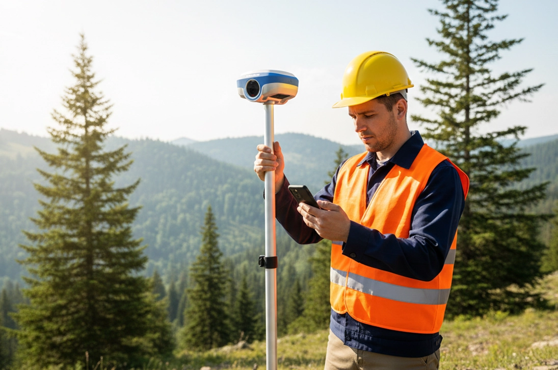
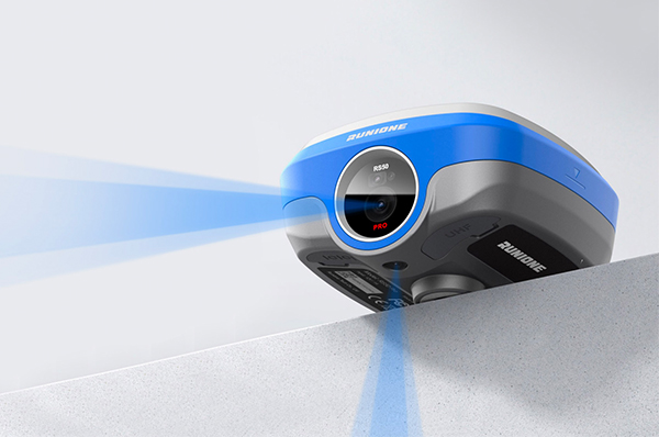
Multi-Source Image Surveying
RS50 Pro combines image-assisted measurement with positioning data to deliver multi-source, non-contact surveying capabilities. It provides stable and reliable results even in GNSS-challenged or high-risk areas.
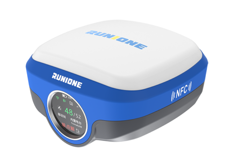
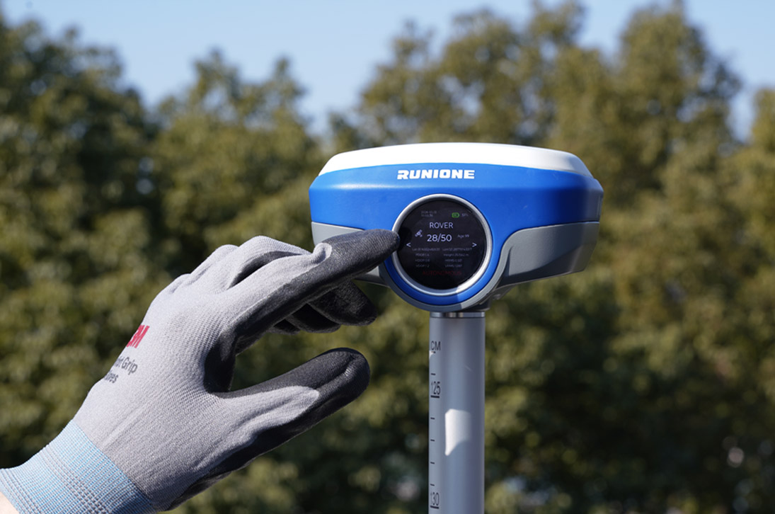
Intuitive Device Interaction
The round touch display serves as the system’s interaction hub, presenting key status and operational information, and supporting quick configuration and workflow switching to enable efficient operation in complex field scenarios.
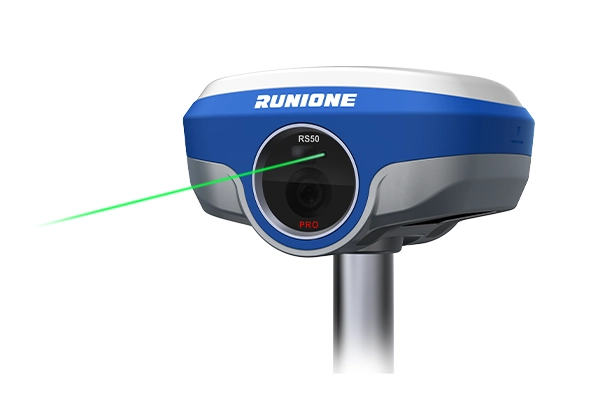
RS50 Pro integrates green laser measurement with heading information, enabling non-contact measurement of points that are difficult to reach using conventional methods. It delivers approximately 3 cm accuracy within 10 meters, providing stable and repeatable data for complex near-range targets.
The dual-camera system, composed of a bottom 5 MP AR camera and a front 2 MP high-definition auxiliary camera, overlays measurement data onto the real-scene view and provides visual guidance. It enables fast and intuitive real-scene stakeout while ensuring accurate spatial positioning throughout the process.
Based on image measurement algorithms and spatial computation models, the system achieves approximately 2–4 cm accuracy within 10 meters (95% confidence level). By jointly processing image and positioning data, it enhances measurement reliability and consistency in complex environments.

The built-in high-stability IMU module supports automatic tilt compensation without initialization. It maintains approximately 3 cm measurement accuracy within a 120° tilt range, ensuring continuous and reliable measurements even in non-standard device orientations.
| Physical Characteristics | |
| Dimension | 130 x 130 x 75 mm |
| Weight | 880g |
| Button | 1 x Power |
| 1 x USB Type-C | Charging, data download |
| 1 x SIM Card Slot | 1 x Nano-SIM card slot |
| 1 x TNC | UHF antenna interface |
| 1 x 5-pin LEMO port | power supply,RS232,external radio communication port |
| Laser assisted | 2.0 MP |
| AR camera | 5.0 MP |
| Battery | Li-Ion 7.4V 6600mAh (48.84wh) ,Built-in |
| GNSS Performance | |
| Channels | 1408 |
| Signals tracking | GPS:L1C/A,L2C,L2P,L5 GLONASS:L1,L2 BDS:B1,B1C,B2,B2a,B2b,B3 GALILEO:E1,E5a,E5b,E6 QZSS:L1,L2,L5,L6 SBAS:WAAS,EGNOS,MSAS, GAGAN,SDCM |
| RTK surveying (baseline<30km) | H:8mm+1ppm RMS V:15mm+1ppm RMS |
| Laser measurement | 3 cm within range 10 m |
| Photogrammetry accuracy | 2~4 cm 95% (10m,normal lighting conditions) |
| Laser distance | 0.05m ~ 30m |
| Communication | |
| Internal UHF | 2W receiver and transmitter Typical 8km working distance |
| Wi-Fi | 802.11 a/b/g/n/ac ( 2.4 & 5GHz ) |
| Bluetooth | 5.2 Classical / BLE proprietary dual-mode |
| NFC | 13.56MHz 14443A |
| Cellular network | LTE-FDD: B1/ 3/ 5/ 7/ 8/ 20 LTE-TDD: B38/ 40/ 41 UMTS: B1/ 8 GSM: 900/ 1800 |
| Reliability | |
| Operating Temperature | – 30℃ to +70℃ |
| Storage Temperature | – 40℃ to +80℃ |
| Operating Humidity | 0% to 100% RH, non-condensing |
| Shock | MIL-STD-810H |
| Vibration | MIL-STD-810H |
| IP rating | IEC 60529-2013 IP67 |
Become Partner
CONTACT SALESSpec Sheet
DOWNLOAD
Runione Survey is professional GNSS survey software designed for engineering measurement and construction stakeout. Built around stability, reliability, and efficiency, it enables surveyors to deliver consistent and trustworthy results in real-world construction environments.